
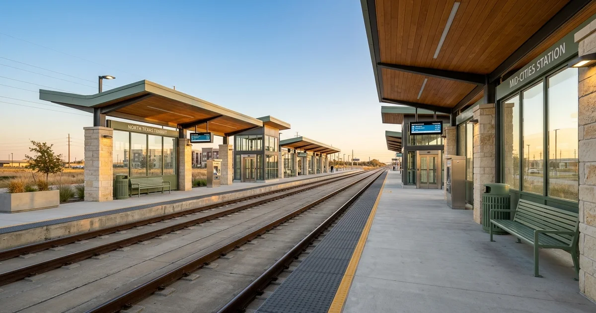
What is the DART Silver Line?
We constantly field questions from local property owners about how new transit options impact their real estate investments. The recent completion of the DART Silver Line completely shifts the commuter landscape across North Texas. This 26-mile commuter rail officially launched on October 25, 2025.
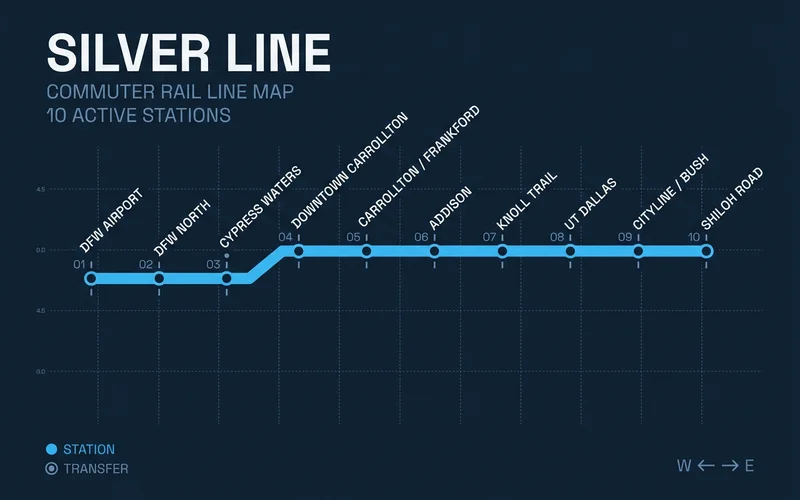
Our team monitors the DART Silver Line route closely because it connects over 210,000 jobs within a half-mile radius of the tracks. Modern Stadler trains now serve 10 distinct stations from Plano straight to DFW Airport Terminal B. If you are evaluating properties or weighing new apartments near transit, this addition finally provides a direct east-west connection that bypasses downtown Dallas entirely.
We will detail exactly who benefits from these new stations and explain how to apply this information to your leasing strategy. The data clearly points to specific neighborhoods that now offer superior commute times. Property values and rental demand respond directly to these reduced travel times.
Who does the Silver Line help?
Our data indicates this crosstown route is a massive selling point for tenants working in the northern suburbs. Renters and homeowners searching for DART Silver Line apartments can now skip Interstate 635 entirely when traveling across the north side. Commuters heading to major employment hubs like the State Farm headquarters in Richardson find this especially valuable.
We highly recommend highlighting this rail option to a few specific target demographics. The primary beneficiaries include:
- Airport workers and frequent flyers needing direct service to the DFW Airport Terminal B station.
- Corporate employees commuting between Plano, Richardson, and the Addison business district.
- Riders transferring to the Red and Orange lines at CityLine/Bush. A downtown Dallas commute still requires a transfer to a southbound train.
Our agents always remind clients that the Silver Line alone will not get a tenant into the city center. Renters must switch to a different line to reach those downtown office buildings. A smooth transfer makes the trip possible, but it does add time.
Which stations matter for renters?
Our property maps carefully track the exact walking distance from new buildings to these specific transit points. A station that looks incredibly close on a digital map might actually sit across an impassable eight-lane highway. The new UT Dallas Station in Richardson stands out as a prime location.
We see massive rental demand near this stop because it serves a campus of over 30,000 students. Another major focal point is the Downtown Carrollton station. This stop provides excellent walkability and links residents straight to the Green Line.
Our advice is to physically walk the route from any prospective building to the platform. Buyers and landlords evaluating transit-adjacent properties must verify safe pedestrian access. The true value of a transit property relies on how easily a person can reach the train on foot.
Our team tells every client that today’s map is your lease’s map. No new Dallas-side rail opens in 2026 or 2027. If a building’s pitch leans on future transit, judge it on the lines running now.
How does it connect to other lines?
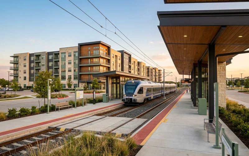
Our favorite feature of this expansion is how it links previously isolated commuter zones. The integration with existing infrastructure creates a much stronger regional network. You can view the major transfer points in the chart below.
| Connection | What it gives you |
|---|---|
| Red and Orange lines at CityLine/Bush | Richardson, Plano, and downtown via transfer |
| DFW Airport Terminal B | Direct airport access |
| Green Line at Downtown Carrollton | Access to Farmers Branch and the Medical District |
| TEXRail at DFW Airport North | Fort Worth and Grapevine regional trips |
We always point out the TEXRail connection to clients who have business in Tarrant County. This transfer at DFW Airport North allows a direct train ride from East Plano all the way into downtown Fort Worth. The CityLine/Bush transfer remains the busiest hub for reaching the corporate offices in downtown Dallas.
What about service changes elsewhere?
Our tracking of local transit politics shows that service maps can shrink as well as grow. Highland Park officially voted on May 2, 2026, to withdraw from the transit network. All bus and GoLink services within the town limits ceased on May 14, 2026.
We actively update our neighborhood profiles to reflect these missing routes, including the discontinued Route 237. The May 2026 election results created a mixed transit map:
- Highland Park: Withdrew from the system entirely.
- Addison: Voted to remain in the network.
- University Park: Also elected to stay. The Highland Park exit does not alter the actual Silver Line track or train schedule.
Our property reports now place extra emphasis on verifying active bus routes before you sign a lease. A neighborhood that had excellent bus coverage last year might have completely different service today. Checking current schedules directly on the official transit website prevents unpleasant surprises.
Should a Silver Line station decide your building?
We suggest prioritizing rail access only if your daily trip directly utilizes the train. Train proximity holds the most financial value when it replaces a tolled drive or an expensive parking garage contract. Tollway costs in North Texas continue to take a significant bite out of household budgets.
Our latest calculations show a standard commute on the Dallas North Tollway adds up quickly. A typical drive from Frisco to downtown Dallas runs 22 cents per mile with an NTTA TollTag in 2026. The current toll structure heavily penalizes drivers without tags:
| Payment Method | Cost Per Mile | Estimated Monthly Commute Cost |
|---|---|---|
| NTTA TollTag | $0.22 | ~$220 |
| ZipCash (Mail) | $0.44 | ~$440 |
Our rail vs tollway guide compares these exact expenses for different North Texas corridors. Drivers who use ZipCash pay double the standard rate, making the financial case for public transit even stronger. The near work page ranks buildings by total drive time for those who still prefer their cars.
How do we show rail on the board?
We designed a specific visual system to help you spot transit-friendly properties instantly. Every building near a train stop carries a visible rail chip on its listing. This indicator displays the specific train line and the actual walking time to the platform.
Our system updates these new buildings near stations directly from the morning feed. The walking times calculate the true pedestrian path, factoring in crosswalks and sidewalks. An estimated walk of under 15 minutes generally indicates a highly practical transit commute.
What’s the next step?
We are ready to help you narrow down the best locations for your specific goals. Tell the team your primary destination and whether you prefer to drive or ride. A customized search will reveal buildings with a realistic walk to the right station.
We compare those transit options directly against local driving routes to ensure you make the smartest choice. Taking the guesswork out of the process saves both time and money. Start your search today and Get my shortlist.